

Garrison dam has turned into quite the tourist attraction this year with the first ever spillway opening and the high release levels.
I wasn't all that interested in going there because I had already seen photos and videos online.
I was wrong.
Much more impressive to go there in person and have the sensory experience of that water bursting and splashing out.
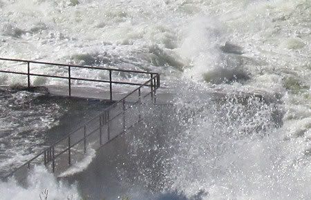
The down side is that viewing areas are more restricted so everyone sees only a few views and everyone is taking the same photos and the same videos. They have the spillway parking area so blocked up that at first I didn't even think we could get over to the west side where the water is rushing out. But you can. You can still park in a portion of the parking lot and then you walk across the highway over to the west side of the spillway. It is blocked for vehicle traffic, but foot traffic is still allowed.
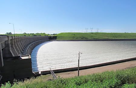
The spillway has to be photographed facing the sun (South). High contrast situation. It was a challenge photographing/videoing the water and I didn't like my results much. We were there in the morning. I don't know if late afternoon would be any better for photography. The spillway is East/West direction.
There is usually an abundance of birds, including pelicans, to photograph around the dam area when the water isn't booming out. I could see birds in the far distance, so they were still around, just too far away to photograph.
Video
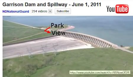
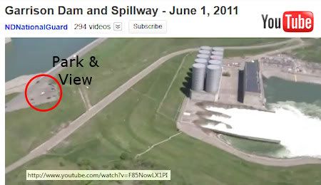
NDNG Aerial View of Garrison Dam
Video2
OmahaUSACE - Corps so better viewing access/different views.
Dated 6 Jun 11 - my notes say maybe about 120,000 cfs.
usace website
Video3
Typical tourist views.
Dated 11 Jun 11 - my notes say about 135,000 cfs.
This is what I have for later scheduled releases:
17 Jun11 - 150,000 cfs (That was the maximum.)
27 Jun 11 - 145,000 cfs
09 Jul 11 - 140,000 cfs
After 09Jul11, the releases will gradually be reduced by 5,000 cfs.
18 Jul 11 - 120,000 cfs
29 Jul 11 - 110,000 cfs
The schedule changes all the time.
Corps says effective 6 Jul 11, releases will be 140,000 cfs, so they must have reduced it sooner than previously scheduled.
I think the river level at Bismarck peaked at 19.25 feet on
01 Jul 11.
(Bismarck/Mandan - twin cities.)
That will probably be the crest reported for the year 2011.
The river hasn't been that high since the Garrison dam was built and in operation (1953).
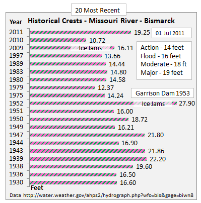
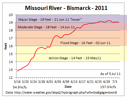
Charts mine, data here.
North Dakota Rivers - Missouri, Little Missouri highlighted:
(Note flooding in Williston and Medora area also.)
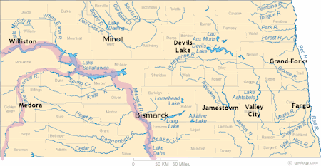
ND Rivers
ND Cities
(Layer the two on top of each other.)
NOTE on cfs:
1 cubic feet per second (cfs) = 7.48 gallons per second
7.48 x 60 = 448.8 gallons per minute
448.8 x 1,440 = 646,272 gallons per day
140,000 cfs x 646,272 = 90,478,080,000 gallons per day
No comments:
Post a Comment